About the Author:
Co-Direttrice della Missione.
Licia – who has written 35 posts on Abu Tbeirah.
![]() •
• ![]() •
• ![]() •
• ![]()
 Coordinates 31° 17′ 9.00” – 45° 51′ 13.00″ / 31.285833° N – 45.853611° E
Position: The ancient site is situated 47 km northwest of Nasiriyah, some 25 kilometers southeast of the mounds of Uruk, near the east bank of the Shatt-en-Nil canal and 33 km south-west from Shatra.
Chronological frame: The site has had a lengthy occupation, from the Ubaid period in the fifth millennium BC to the Parthian period. Principal period of occupation: late 3rd millennium BC to circa 1750 BC.
Excavations and Brief History of the Site:
The site was first excavated by William Loftus in 1850 for less than a month. In those early days of archaeology, the effort was more focused on obtaining museum specimens than scientific data and niceties like site drawings and findspots were not yet in common usage. Loftus recovered building bricks of Nebuchadnezzar II of the Neo-Babylonian Empire which enabled the sites identification as the ancient city of Larsa. Much of the effort by Loftus was on the temple of Shamash, rebuilt by Nebuchadnezzar II. Inscriptions of Burna-Buriash II of the Kassite dynasty of Babylon and Hammurabi of the First Babylonian Dynasty were also found. Larsa was also briefly worked by Walter Andrae in 1903. The site was inspected by Edgar James Banks in 1905. He found that widespread looting by the local population was occurring there.
The first modern, scientific, excavation of Tell Senkereh occurred in 1933, with the work of Andre Parrot. Parrot worked at the location again in 1967. In 1969 and 1970, Larsa was excavated by Jean-Claude Margueron. Between 1976 and 1991, an expedition of the DelégationArchéologiqueFrançaise en Iraq led by J-L. Huot excavated at Tell Senkereh for 13 seasons. Site condition: in May 2003, a group of scholars travelling with Major Sadowski and a platoon of Marines saw evidence of extensive looting, the most extensive and recent digging having occurred at some of the large baked-brick buildings where a team of French archaeologists working at Larsa during the 1970s and 1980s had discovered an archive of clay tablets with cuneiform texts. The excavation house built by the French had been destroyed after the 1991 Gulf War, and the site guard had been murdered. There was no sign of the present site guard; his house had been destroyed. Since that time, the site has been only intermittently guarded, because it occupies the border between two provinces, making it unclear which jurisdiction is responsible for the site.
An important Sumerian city, ruled also by a dynasty that exercised control over southern Mesopotamia in the early years of the second millennium.
As one of the earliest Sumerian cities, Larsa seems to have been part of some kind of league or confederation, as its emblem is on the “city seal” impression from Jemdet Nasr. Inscriptions from around 2700 BC record the rebuilding at Larsa of the E-Babbar (“Shining House”), temple of Shamash, the city god. Ur Nammu of Ur III also rebuilt this complex, which consisted of a temple and ziggurat, and which continued to function into the Neo-Babylonian period.
Larsa first became a formidable force in Mesopotamia during the Old Babylonian period (c. 2000-1600 BC). After the Third Dynasty of Ur collapsed, a power vacuum arose that many of the larger city-states hurried to fill. Amorite tribes suddenly made their appearance, and it was one of these tribal leaders, Gungunum, who established an independent dynasty in Larsa, challenging the reigning dynasty of Isin, capturing Ur, and even giving himself the old title “King of Sumer and Akkad”. Gungunum’s successors continually chipped away at Isin’s territory, cutting off its access to canals. As Isin continued to lose political and economic ground, the situation reached a tipping point: Isin was finally conquered around 1800 BC by the long-ruling (60 years!) Rim Sin of Larsa, who was, in turn, conquered by Hammurabi of Babylon in 1763 BC.
Even at its height, the Larsa dynasty only controlled 10-15 city states, nowhere near the territory controlled by other dynasties in Mesopotamian history. Nevertheless, huge building projects and agricultural undertakings can be validated by archaeological evidence.
Present Situation:
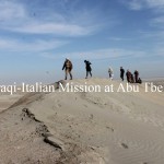
The street to go to Larsa (Tell Senkereh) from Nasiriyah is adequate only up to 20 km from the provincial capital, then for the next 27 km it is absolutely necessary to have a 4-wheel drive car in order to reach the site. The way not only is not paved, but because of the wind and sand-storm of the area (especially in late spring and summer) there isn’t even a track for the car, so that many times it is necessary to find the way among bushes and sand dunes.
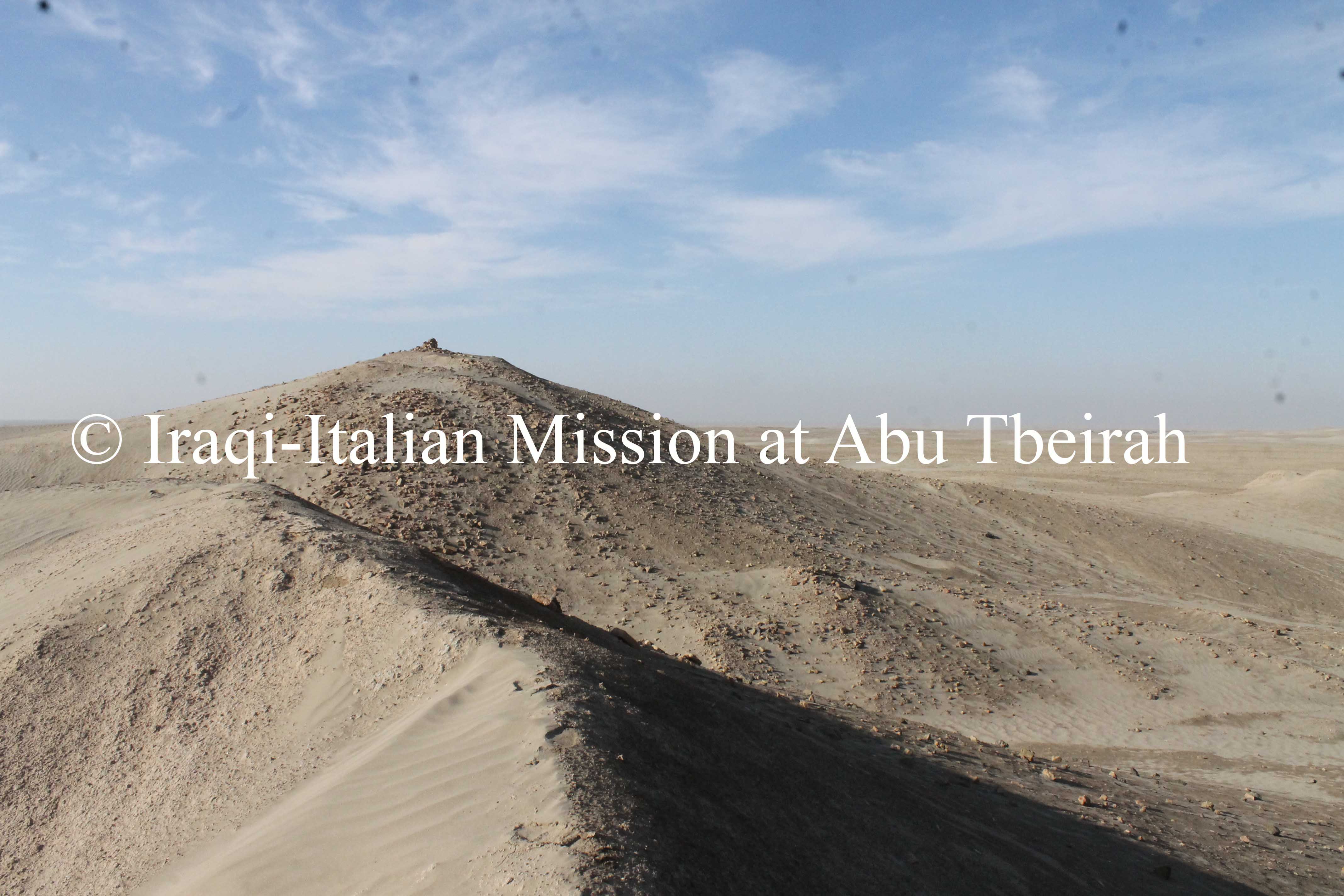
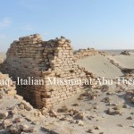
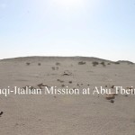
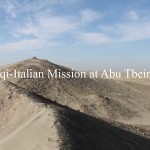
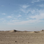
The site itself, in the middle of an area which is mostly not inhabited, is quite impressive and has a peculiar and fascinating romantic appeal, but very few fragments of brick structures are visible (the temple Ebabbar, dedicated to the Sun-god, the base of the ziqqurat, some walls of a house dated to the Old Babylonian period, 1850 BC ca.). In any case, this is the biggest Tell of the area though a lot of other minor Tells or archaeological places can be found, visible also from Tell Senkereh itself, and the entire zone is a sort of big “archaeological reservoir”: in the future, if the area will be scientifically dug and properly developed, the possibility of exploitation of the archaeological remains can be very high.
Coordinate: 31° 17′ 9.00” – 45° 51′ 13.00″ / 31.285833° N – 45.853611° E
Posizione: L’antico sito si trova 47 km a nord ovest di Nassiriya, circa 25 chilometri a sud est delle montagne di Uruk, vicino alla riva orientale del canale Shatt-en-Nil e 33 km a sud-ovest di Shatra.
Quadro cronologico: Il sito ha avuto una lunga occupazione, dal periodo Ubaid nel quinto millennio a.C. fino al periodo partico. Periodo di principale occupazione: fine del 3 ° millennio a.C., risalente al 1750 a.C.
Scavi e breve storia del sito: Il sito fu scavato per la prima volta da William Loftus nel 1850 in meno di un mese. In quei primi giorni di archeologia, lo sforzo è stato focalizzato più su come ottenere esemplari da museo che dati scientifici e accuratezze come disegni del sito e la posizione dei reperti, in quanto non era ancora uso comune. Loftus trovò mattoni da costruzione risalenti a Nabucodonosor II dell’impero neo-babilonese che ha permesso l’identificazione di siti, come l’antica città di Larsa. Gran parte degli sforzi di Loftus furono concentrati sul tempio di Shamash, ricostruito da Nabucodonosor II. Sono state ritrovate anche iscrizioni di Burna-Buriash II della dinastia cassita di Babilonia e di Hammurabi della prima dinastia babilonese. Larsa è stata anche oggetto di lavoro per un breve periodo di Walter Andrae nel 1903. Il sito è stato ispezionato inoltre da Edgar James Banks nel 1905. Lui aveva notato che lì si erano verificati numerosi saccheggi da parte della popolazione locale.
Il primo scavo moderno e scientifico di Tell Senkereh avvenne nel 1933, ad opera di Andre Parrot. Egli scavò di nuovo la località nel 1967. Nel 1969 e 1970, Larsa è stata scavata da Jean-Claude Margueron. Tra il 1976 e il 1991, una spedizione del Delégation Archéologique Française en Iraq guidata da JL. Huot scavò a Tell Senkereh per 13 stagioni. Condizioni del sito: nel maggio 2003, un gruppo di studiosi viaggiando con il Maggiore Sadowski e un plotone di Marines hanno notato la presenza di numerosi saccheggi, come il più ampio e recente scavo avvenuto all’interno di grandi edifici in mattoni cotti, dove un team di archeologi francesi durante gli anni 1970 e 1980 aveva scoperto un archivio di tavolette di argilla con testi cuneiformi. La casa scavo costruita dai francesi era stata distrutta dopo la guerra del 1991, e la guardia del sito era stata assassinata. Non c’era la presenza della guardia del sito; la sua casa era stata distrutta. Da quel momento, il sito è stato custodito ad intermittenza, perché occupa il confine tra due province, il che rende poco chiaro quale giurisdizione è responsabile del sito.
Un’importante città sumera, governata anche da una dinastia che ha esercitato il controllo sulla bassa Mesopotamia nei primi anni del secondo millennio.Come tutte le prime città sumere, Larsa sembra essere stata parte di un qualche tipo di alleanza o confederazione, come è il suo stemma impresso sul “sigillo della città” dal Jemdet Nasr. Le iscrizioni relative al 2700 a.C. registrano la ricostruzione a Larsa dell’ E-Babbar (“Casa Splendente”), ovvero il tempio di Shamash, il dio della città. Anche Ur Nammu di Ur III aveva ricostruito il complesso, che consisteva in un tempio e nella ziggurat, e che ha continuato a funzionare nel periodo neo-babilonese.
Inizialmente Larsa divenne una grande forza in Mesopotamia durante il periodo antico babilonese (c. 2000-1600 aC). Dopo la caduta della Terza Dinastia di Ur, molte delle più grandi città-stato si affrettarono a riempire quel vuoto di potere appena sorto. Fecero la loro improvvisa comparsa tribù di amorrei, ed è stato uno tra questi capi tribali, Gungunum, a ristabilire una dinastia indipendente in Larsa, a sfidare la dinastia regnante di Isin, a conquistare la città di Ur, e a darsi il vecchio titolo di “Re di Sumer e di Akkad” . I successori di Gungunum continuarono a ridimensionare il territorio di Isin e a tagliare l’accesso a canali. Poichè Isin continuava a perdere terreno politico ed economico, la situazione raggiunse il suo punto di svolta: Isin fu infine conquistata intorno al 1800 a.C. dalla lunga reggenza di Rim Sin di Larsa (60 anni!) , che venne, a sua volta, conquistato da Hammurabi di Babilonia nel 1763.
Anche al suo apice, la dinastia di Larsa controllava solo 10-15 città-stato, il territorio non è stato sotto il controllo di altre dinastie nella storia mesopotamica. Tuttavia, i progetti delle grandi costruzione e le aziende agricole possono essere convalidate dalle testimonianze archeologiche.
Situazione attuale:
La strada per andare a Larsa (Tell Senkereh) da Nassiriya è adatta solo fino a 20 km dal capoluogo di provincia, poi per i successivi 27 km è assolutamente necessario avere una macchina a 4 ruote motrici, per raggiungere il sito. La via non solo non è asfaltata, ma a causa del vento e della tempesta di sabbia di questa zona (soprattutto in tarda primavera e in estate), non si trova nessun percorso per l’auto, cosicché molte volte è necessario trovare il modo per passare tra cespugli e le dune di sabbia.
Il sito stesso, nel bel mezzo di una zona che non è per lo più abitata, è abbastanza impressionante e ha un peculiare e suggestivo fascino idilliaco, ma sono molto pochi i frammenti di strutture in muratura visibili ( il tempio dell’ Ebbabar, dedicato al dio Sole, la base della ziqqurat, alcuni muri di una casa datata al periodo antico babilonese, 1850 aC ca.). In ogni caso, questo è il più grande Tell dell’area sebbene si possono trovare molti altri tell minori o siti archeologici, visibili anche dallo stesso Tell Senkereh, tutta la zona è una sorta di grande “serbatoio archeologico”: in futuro, se l’area sarà scavata in modo scientifico e valorizzata in modo adeguato, la possibilità di sfruttamento dei resti archeologici potrà essere molto elevata.