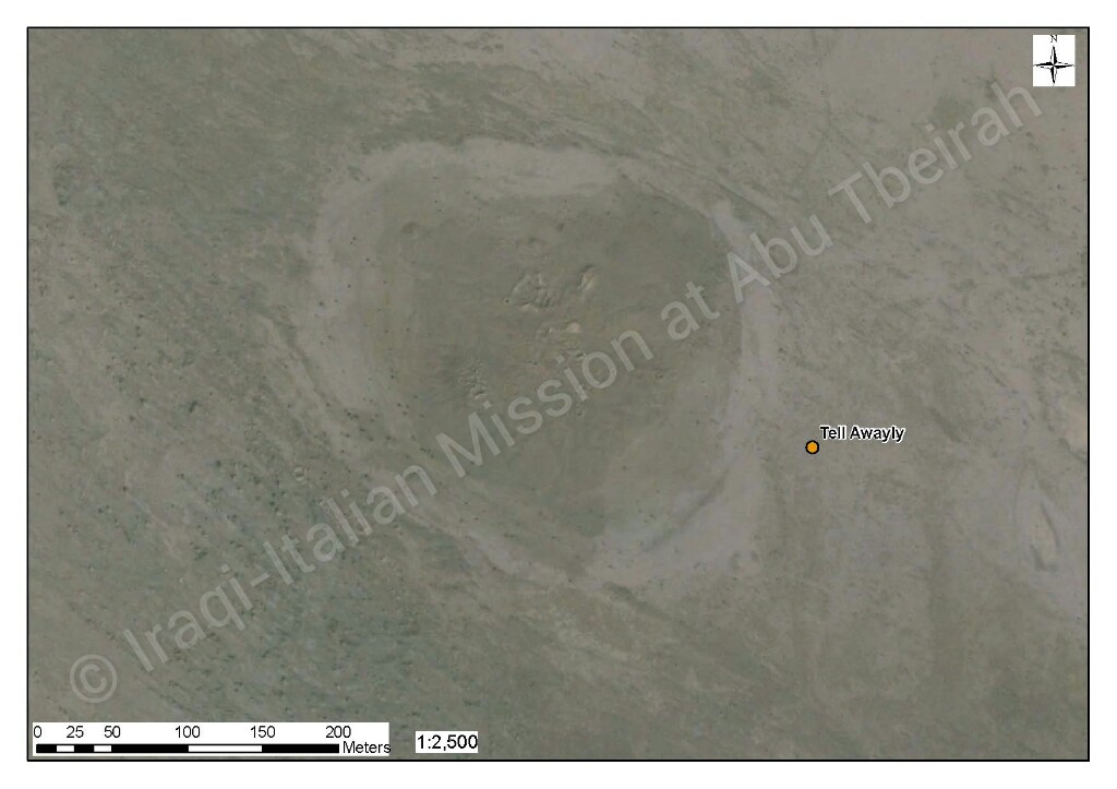
Geografic coordinate:
31° 14′ 31.4088″- 45° 53′ 14.4600″
31.242058°N-45.887350° E
Governatorate – District – Sub-district:
Dhi-Qar – Nasiriyah – al Bathaa
Nearest City:
A short distance from Larsa (southeast). 32 km south-west from Shatrah. 43 km north-west from Nasiriyah.
Chronological frame:
Ubaid period (5000–3800 BC) or earlier, (calibrated radiocarbon dates suggest circa 4500 BC).
Excavations:
French, 1980s.
Description:
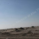
This small mound, partly above the level of the surrounding plain and partly below the water table, was abandoned before the emergence of urban centers, and is entirely Ubaidain. Two deep soundings allowed the excavators to define 20 levels, of which the top 11 were Ubaid, while the next eight yielded a previously unknown pottery, (confusing called Pre-Ubaid or Ubaid Zero) with affinities to Samarra ware, as was the case for the cigar shaped bricks in level 12, similar to those at Tell es Sawwan. Below level 20, (in the water table and not able to be excavated) was evidence of more occupation, possibly going back to the Neolithic.
Present situation:
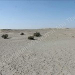
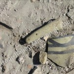
This Tell is at a distance of 15 km from Kutalla, in the same impervious area. It has been excavated by a French archaeological mission in the 80s, even if no structure whatsoever is to be seen on its surface. The site is dated to the late pre-historic period, so called Ubaid period (5500-4500 BC), and on its surface thousands of pottery shards belonging to that chronological span can be seen. Admittedly, the fascinating colours of the pottery of this period makes the visit to the Tell very interesting for a professional, but obviously not so for the novice.
Coordinate Geografiche:
31° 14′ 31.4088″- 45° 53′ 14.4600″
31.242058°N-45.887350° E
Governatorato-Distretto-Sub-distretto:
Dhi-Qar – Nasiriyah – al Bathaa
Città più vicina:
Poco distante da Larsa (a sud-est). 32 km a sud-ovest di Shatrah. 43 km a nord-ovest di Nasiriyah.
Quadro cronologico:
Periodo Ubaid (5000-3800 a. C.) o prima, (la calibrazione del radiocarbonio suggerisce come data 4500 a.C.)
Scavi:
Francese, 1980.
Descrizione:
Questo piccolo tumulo, è in parte al di sopra il livello della piana circostante e, in parte al di sotto della falda acquifera, è stato abbandonato prima della comparsa di centri urbani ed è interamente del periodo Ubaid. Due sondaggi profondi hanno permesso agli scavatori di classificare 20 livelli, di cui gli 11 strati superiori erano Ubaid, mentre i successivi otto hanno consegnato una ceramica che in precedenza era sconosciuta, (poco chiara chiamata Pre-Ubaid o Ubaid-Zero), con affinità agli oggetti di Samarra, come era per il caso dei mattoni a forma di sigaretta nel livello 12, simili a quelli di Tell es Sawwan. Sotto il livello 20 (nella falda acquifera non è stato potuto scavare) era evidente la presenza di molte occupazioni, forse risalenti al Neolitico.
Situazione attuale:
Questo Tell si trova ad una distanza di 15 km da Kutalla, nella stessa area impervia. È stato scavato da una missione archeologica francese negli anni ’80, anche se nessuna struttura è stata vista sulla sua superficie. Il sito è datato al tardo periodo pre-storico, così chiamato periodo Ubaid (5500-4500 aC), e sulla sua superficie possono essere visti migliaia di cocci di ceramica appartenenti a tale arco cronologico. Certo, gli affascinanti colori della ceramica di questo periodo rende la visita del Tell molto interessante per un professionista, ma ovviamente non è così per i principianti.