Modern name:
Tell al-Ubaid
Ancient name:
Unknown
Geographic coordinate:
30.972337°N 46.030580°E
38R NV 98384 MGRS 27041
Governatorate – District – Sub-district:
Dhi-Qar – Nasiriyah – Ur
Nearest City:
About 8 km West of Ur. 25 km south-west from Nasiriyah.
Chronological frame:
Ubaid (5500-4000 BC) through Early Dynastic period (until 2400 BC).
Excavations:
The site was first excavated by H. Hall of the British Museum in 1919. Later, L. Woolley excavated there in 1923 and 1924, followed by S. Lloyd and P. Delougaz in 1937, the latter working for the Oriental Institute of the University of Chicago.
Historical Remarks:
Excavations revealed a Sumerian city with a pottery sequence of the Ubaid period which has given the modern name of the Tell. Ubaid ware is painted in geometric designs and often fired at very high temperatures, resulting in a greenish color. Other characteristic artifacts of the Ubaid period include bent clay nails (for attaching reed matting to clay walls?), sickles, weights, all of baked clay, as well as distinctive baked clay figurines, male and female, with conical headdress and coffee-bean eyes, and a slightly lizard like appearance. Copper artifacts appear infrequently.
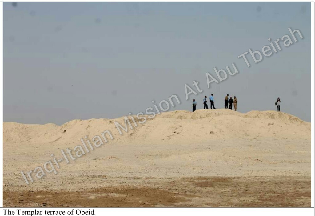
In the Early Dynastic period, a temple to Ninhursag, Sumerian mother goddess, was built. Like the temple at Kafajah (Central Iraq), the Temple was surrounded by an oval shaped enclosure wall. A great bronze panel, eight feet wide, decorated the temple, showing the projecting figure of a lion-headed eagle, the god Imdugud, between two stags, and might have decorated the main doorway, supported by two columns decorated with colored inlay of bitumen, red limestone and mother of pearl. The wall-faces nearby were decorated with three dimensional friezes of animals, including lions, molded in high relief and sheathed in copper.
Present Situation:
The street leading from Nasiriyah (or Ur) to Ubaid is quite good (“as-sariyah”), but the last 400 m are unpaved and a 4-wheel car is recommended.
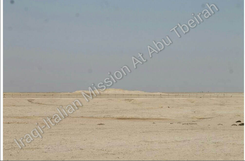
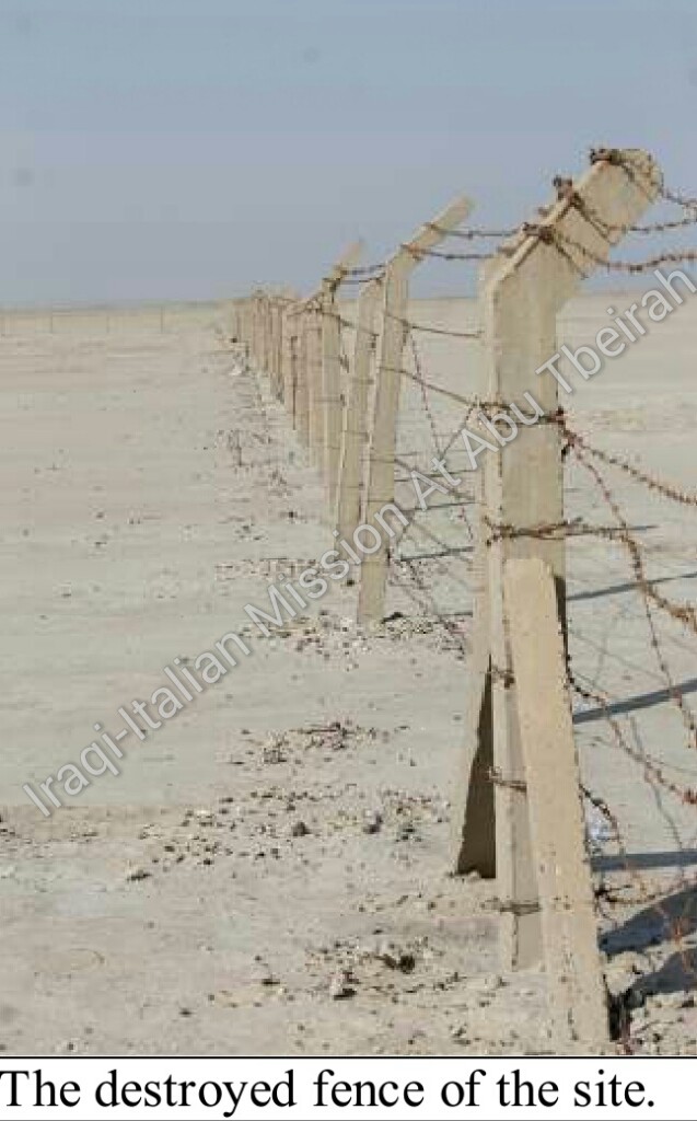
The site is quite small (ca. 5 ha) and not tall (the Ziqqurat is completely washed away and is hardly recognizable), and an un-experienced eye could not detect it as an archaeological area; in addition no indication on the presence of the Tell is to be found along the route. The site itself is surrounded by an old and partly damaged barbed wire which needs restoration (at the entrance it is necessary to jump a tangle of barbed wire).
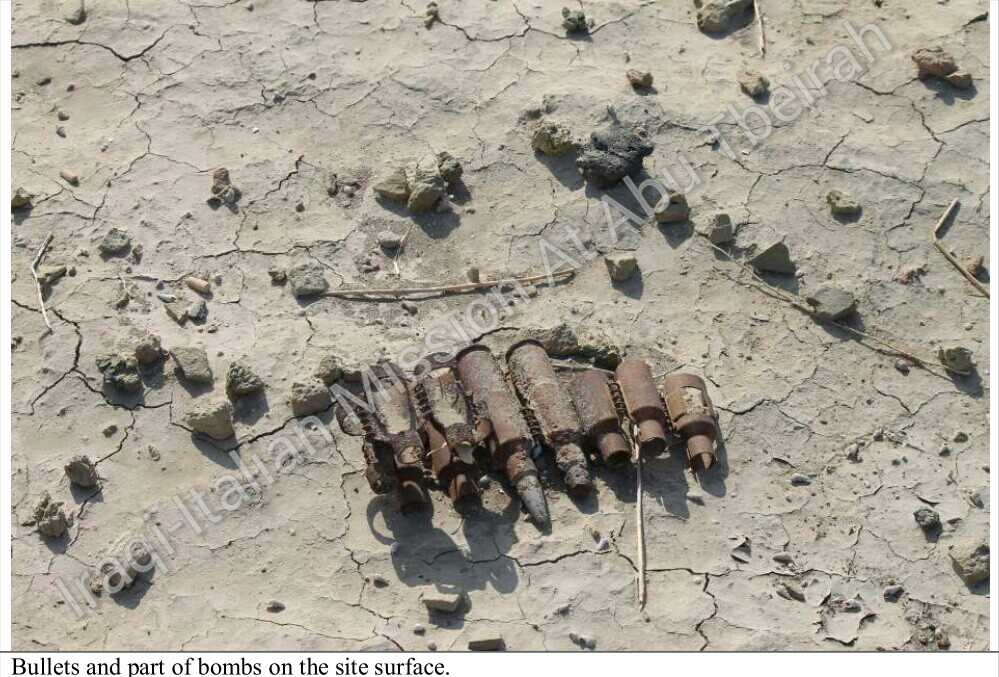
The site is very near a check-point of the oil police, which allows an indirect control on the remains (no looting has been reported for this site). On the site itself, no structure of the old buildings is visible today and no indication is placed in order to remind to the visitor of the historical importance of the Tell; no facility, able to welcome and accommodate tourists, is built in the area. Striking is the presence on the archaeological area of a huge quantity of rubbish (plastic bags and bottles, bullets, part of bombs etc.).
In order to include the site in a touristic itinerary, it is necessary a complete cleaning and a new campaign of digging aimed at clarifying the planimetry of the ancient structures, beyond a series of information boards.
Accessibility:
The site, as said above, is very easily reachable and very near to the main street.
Visibility:
As already stressed, the lack of any visible archaeological structure on the site makes it very poorly tempting for touristic purposes.
Nome moderno:
Tell al-Ubaid
Nome antico:
Sconosciuto
Coordinate geografiche:
30.972337°N 46.030580°E
38R NV 98384 MGRS 27041
Governatorato-Distretto-Subdistretto:
Dhi-Qar – Nasiriyah – Ur
Città più vicina:
Circa 8 km a ovest di Ur. 25 km a sud-ovest di Nassiriya.
Quadro cronologico:
Ubaid (5500-4000 a.C.) con l’inizio del protodinastico (fino al 2400 a.C.).
Scavi:
Il sito è stato scavato per la prima volta da H. Hall del British Museum nel 1919. In seguito, L. Woolley ha scavato lì nel 1923 e 1924, seguito da S. Lloyd e P. Delougaz nel 1937, quest’ultimo lavorava per l’Istituto Orientale dell’Università di Chicago.
Cenni storici:
Gli scavi hanno rivelato una città sumera con una sequenza ceramica del periodo Ubaid che ha dato il nome moderno del sito.La ceramica del periodo Ubaid è dipinta a motivi geometrici e spesso cotta a temperature molto elevate, che ha come conseguenza un colore verdastro. Altri manufatti caratteristici del periodo Ubaid sono chiodi di argilla curvi (per collegare stuoie di canne a muri di argilla), falci,pesi, tutti in terracotta, così come statuine distinte di terracotta, maschili e femminili, con copricapo conico e occhi a forma di chicco di caffè, e con l’aspetto leggermente simile ad una lucertola. Nel periodo proto-dinastico è stato costruito, un tempio per Ninhursag, dea madre sumerica. Come il tempio di Kafajah ( Iraq centrale), il tempio era circondato da un muro di cinta di forma ovale. Un grande pannello in bronzo, largo otto piedi, decorava il tempio, che mostra la figura sporgente di un’aquila dalla testa di leone, il dio Imdugud, tra due cervi, e potrebbe aver decorato la porta principale, sostenuta da due colonne decorate con intarsi colorati di bitume , calcare rosso e madreperla. Le facce del muro vicino sono state decorate con tre fregi tridimensionali di animali, tra cui leoni, modellati in altorilievo e rivestiti in rame.
Situazione attuale:
La strada che porta da Nassiriya (o Ur) ad Ubaid è abbastanza buona (“as-Sariyah”), ma gli ultimi 400 m sono sterrati ed è consigliata una macchina a 4 ruote motrici.
Il sito è abbastanza piccolo (circa 5 ettari) e non alto (la Ziqqurat è stata completamente spazzata via ed è difficilmente riconoscibile), un occhio non esperto non potrebbe localizzarla come un’area archeologica; inoltre lungo il percorso non si trova nessuna indicazione sulla presenza del tell. Il sito stesso è circondato da un vecchio e in parte danneggiato filo spinato che necessita di ristrutturazione (all’ingresso, è necessario passare un groviglio di filo spinato). Il sito è molto vicino ad un punto di controllo del petrolio, che consente una vigilanza indiretta sulle rovine (per questo sito non è stato riportato nessun saccheggio). Sul sito stesso, nessuna struttura dei vecchi edifici è oggi visibile e nessuna indicazione viene posta per ricordare al visitatore l’importanza storica del tell; nella zona nessuna struttura in grado di accogliere e ospitare i turisti è stata costruita. Suggestiva è la presenza sulla zona archeologica di una quantità enorme di rifiuti (sacchetti di plastica e bottiglie, proiettili, frammenti di bombe, ecc). Al fine di includere il sito in un itinerario turistico, è necessaria una pulizia completa e una nuova campagna di scavi volta a chiarire la planimetria delle antiche strutture, al di là di una serie di pannelli informativi.
Accessibilità:
Il sito, come detto sopra, è veramente facile da raggiungere e molto vicino alla strada principale.
Visibilità:
Come già sottolineato, la mancanza di qualsiasi struttura archeologica visibile sul sito, lo rende poco allettante per scopi turistici.